Supporting the Investigation of Aircraft Accidents using RPAS
DOI:
https://doi.org/10.18667/cienciaypoderaereo.654Keywords:
Air Accidents; Drones; Investigation; Image Processing; RPAS (Remotely Piloted Aircraft System); Air SafetyAbstract
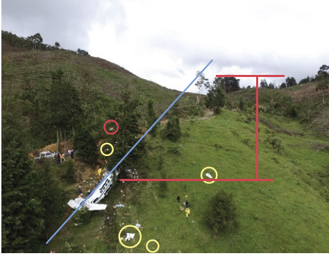
This paper presents a study for the implementation of RPAS (Remotely Piloted Aircraft System) in the investigation of an aircraft accident, with the purpose of evaluating the relevance of this technology as a tool for Accident Investigation Groups (AIG) worldwide. A technical review of the general capabilities of the RPAS and a “Base line” analysis based on a weight classification approach is done, making reference to the data of each aircraft, contained in their corresponding data sheet, which would facilitate obtaining images and other data at the scene. Multi-rotor RPAS with specialized sensors for specific missions and also the regulations that require their implementation at the scene of the plane crash were analyzed. Also, current procedures are compared with those that would include the use of rpas in that scene. Finally, special attention is paid to technology, aircraft class, sensory, modes of operation, time and costs, which concludes that the implementation of RPAS facilitates obtaining images and other data at the scene. This technology could be included as one of the tools that an accident investigator must use in his work.
Downloads
References
Aerocivil. (2016, 13 de septiembre). Investigación de accidentes e incidentes graves. http://www.aerocivil.gov.co/autoridad-de-la-aviacion-civil/investigacion-de-accidentese-incidentes-graves
Aerocivil. (2018). Resolución 04201. Por la cual incorporan a la norma rac91 de los Reglamentos Aeronáuticos de Colombia unas disposiciones sobre operación de sistemas de aeronaves no tripuladas uas y se numeran como Apéndice 13, y se adoptan otras disposiciones. Unidad Administrativa Especial de Aeronáutica Civil.
Aeronáutica Civil de Colombia. (2015). Reglamento Aeronáutico de Colombia. Aeronáutica Civil de Colombia.
Airgomedia.com. (2017, 20 de enero). Northwestern presenta un currículo de drones para investigaciones y reconstrucciones de accidentes de tránsito. https://www.airgomedia.com/2017/01/20/deciding-on-a-drone/
Bell, P. L. (2012). Colombia: manual Comercial e Industrial. Banco de la República.
Díaz, J. J. (2015). Estudio de Índices de vegetación a partir de imágenes aéreas tomadas desde uas/rpas y aplicaciones de estos a la agricultura de precisión [Tesis de Maestría no publicada]. Universidad Complutense de Madrid.
Flight Safety Foundation. (2017, 22 de junio). u.k. aaib Lauds Use of Drones in Accident Investigations. https://flightsafety.org/u-k-aaib-lauds-use-drones-accident-investigations/
Gómez, L., Parra, J., Vélez, J., Avellaneda, J., & Ospina, L. (2017). Proposal to Use uas in the Investigation of Aviation Accidents in Colombia. ieee/aiaa 36th Digital Avionics Systems Conference (DASC), 1-6. https://doi.org/10.1109/DASC.2017.8102149
Martín, J. R. (2008). Curso de fotogrametría digital. Universidad Politécnica de Madrid.
Martínez Tobón, C. D., Aunta Duarte, J. E., & Valero Fandiño, J. A. (2013). Aplicación de datos lidar en la estimación del volumen forestal en el parque metropolitano bosque San Carlos. Ciencia E Ingeniería Neogranadina, 23(1), 7-21. https://doi.org/10.18359/rcin.229
Martorell, A. (s.f.). Comparativa de programas para fotogrametría. https://geoinnova.org/blog-territorio/comparativa-de-programas-para-fotogrametria/
Organización de Aviación Civil Internacional (oaci). (s.f.). Sobre la oaci. https://www.icao.int/about-icao/Pages/ES/default_ES.aspx
Organización de Aviación Civil Internacional (oaci). (2001). Anexo 13. Investigacion de accidentes e incidentes de aviación. oaci.
Organización de Aviación Civil Internacional (oaci). (2015). Manual de investigación de accidentes e incidentes de aviación. oaci.
Parra, J. E. (2017, 3 de mayo). Tendencia dron en Colombia. Centro de Estudios Aeronáuticos. http://www.aerocivil.gov.co/cea/panacea/Pages/Tendencia-drone-en-Colombia.aspx
Pix4D. (2016, 28 de diciembre). Drones fly over aircraft accident scenes in UK: mapping wrecks, not causing them. Medium. https://medium.com/@Pix4D/drones-fly-over-aircraftaccident-scenes-in-uk-mapping-wrecks-not-causingthem-8c01171ffe53 rac 114. (2017). Investigación de accidentes e incidentes de aviación.
Unidad Administrativa Especial de Aronáutica Civil.
Roskam, J. (2003). Airplane Design. The University of Kansas.
Romero, J., & Gomez, L. (2017). Proposal for rpas integration into non-segregated airspaces. 2017 Integrated Communications, Navigation and Surveillance Conference (icns), Herndon, VA, 1-10.
Salamanca Céspedes, J. E., & Pérez Castillo, J. N. (2008). lidar, una tecnología de última generación, para planeación y desarrollo urbano. Ingeniería, 13(1), 67-76. https://doi.org/10.14483/23448393.2090
Sánchez, J. A. (2007) Introducción a la fotogrametría. unsj.
Santos, D. (2014). Fotogrametría usando plataforma aérea uav. Universidad Politécnica de Cataluña
Serna, M. (2015). Uso de aeronaves no tripuladas (rpas) en la conservación preventiva de la propiedad cultural [Proyecto de grado no publicado]. Universidad Politécnica de Valencia.
Universidad de Patras. (2017). uav vs fotogrametría aérea clásica para estudios arqueológicos. Patras.
Vázquez-Tarrío, D., Borgniet, L., Liébault, F., & Recking, A. (2017). Using uas optical imagery and SfM photogrammetry to characterize the surface grain size of gravel bars in a braided river (Vénéon River, French Alps). Geomorphology, 285, 94-105. https://doi.org/10.1016/j.geomorph.2017.01.039
Villarroel, D. D., Scaramuzza, F. M., Méndez, A. A., & Vélez, J. P. (2014). El posicionamiento satelital y sus sistemas de corrección. Curso Internacional de Agricultura de Precisión, 13, 175-182. https://inta.gob.ar/sites/default/files/script-tmp-inta_c3-_el_posicionamiento_satelital_y_sus_sistemas_.pdf

Downloads
Published
Issue
Section
License
Assignment of Copyrights
Authors assign Ciencia y Poder Aéreo journal the exclusive rights (reproduction, distribution, public communication, and transformation) to exploit and commercialize their work, in whole or in part, in all the formats and modalities of present or future exploitation, in all languages, throughout the life of the work and throughout the world.
All contents published in Ciencia y Poder Aéreo journal are licensed under a Creative Commons Attribution 4.0 International License, whose complete information is available at http://creativecommons.org/licenses/by/4.0/
Under the terms of this license, users are free to download, print, extract, archive, distribute and publicly communicate the content of articles, provided that proper credit is granted to authors and Ciencia y Poder Aéreo, scientific journal of the Graduate School of the Colombian Air Force. Except when otherwise indicated, this site and its contents are licensed under a Creative Commons Attribution 4.0 International License.
For other uses not considered under this license it is required to contact the Director or the Editor of the journal at the e-mail address cienciaypoderaereo1@gmail.com.
The Graduate School of the Colombian Air Force and this publication are not responsible for the concepts expressed in the articles, including the metadata or the affiliation stated by authors. This is the full responsibility of the authors.


